Sunday, September 19, 2010

Day 10 - I Survivied Panhandle Gap!

Summerland Camp to Box Canyon

13 Miles / 1600 Elevation Gain

We were up and out of camp by 8:00. At 13 miles it would be our longest hiking day of the entire trip. It was a beautiful morning with blue skies and Rainier out in all her glory:
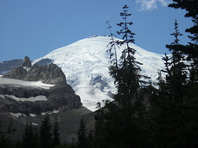

I could really get used to that view even if it meant no flush toilets and floaties in my water. By this point of the trip, I had gotten over my floaties in the water issue but pit toilets will forever and always be an 'only as a last resort option'.

On the way out of camp we stopped to get a picture of the very cool shelter at the group site there:


And then one more crossing of the stream in Summerland. My camera battery was 99% gone at this point. I didn't see any need of saving the battery so I took it out and started shooting until it died for good. A shot of the stream in the Summerland Meadow with the moon just above Rainier:


Once again there was a lot of frost. As we started hiking there were a few slick spots on the trail and a log bridge crossing. I suppose this got us ready for things to come. We arrived at beautiful lake which I can't seem to find on any of my maps. Does it have a name? If anyone out there knows the name of the lake just below Panhandle Gap please let me know so I can insert it here.

Emily at unnamed lake:


It was then time for the snow fields. Fortunately, it started with baby steps. A small snow field where slipping didn't mean certain death:


Views as we climbed up to Panhandle Gap with the moon still above Rainier:


Last picture before my camera died for good:


So now it was just about time. Time to conquer my fear of crossing frozen, icy snow on a steep slope wearing only trail runners. I prayed that a pair of Yak Trax would magically appear on the side of the trail but they didn't. I was fairly certain that this was the end for me but at least I got to hike 90% of the Wonderland Trail first.

Approaching Panhandle Gap:


Curt, of course, didn't give it a second thought and just walked across like a normal person would.

Emily and I both shortened our uphill poles which helped a lot. I told Emily to go ahead and start and think of a happy place as she crossed. She immediately started to repeat, verbatim, the spiel from Tower of Terror at Disneyland. When she got to the part where it said something like "Wave goodbye to the real world" I told her that was enough.

It was still early in the day and the snow had frozen the night before. The track was hard and icy. I realized if you just take it really slowly and use the already present boot tracks it was just fine. I made it about 3/4 of the way when a lady with two young boys showed up on the other side right where I was headed. Curt told her I was still up there thinking she would hold off until I safely made it across. They continued anyway heading straight for me. There was no way I was moving off that boot track so I just kept going. They just walked up on the slope above me and passed me. I finally made it to the other side and I knew at that was the last major obstacle and I would soon be completing the Wonderland Trail.

I probably made too big of a deal about this crossing. Most Wonderland Trail hikers don't give it a second thought. Normally, when we plan day hikes or backpacking trips I avoid these type of conditions. When I found out the WLT would most likely have a "scary" snowfield to cross I knew I'd have to overcome my fear to reach the goal.

As soon as we crossed the gap the conditions immediately changed to extremely foggy with maybe 100 feet of visibility. We never saw the sun or the mountain the rest of the day.I recalled the conversation we had with a counter clockwise hiker a few days earlier. This was his third time hiking the WLT and the day he was in this area it was so foggy he got lost.

Hiking conditions after passing Panhandle Gap:


There were more snowfields to cross too. I remember at one point looking uphill (to my right) and seeing a big steep snowfield. I thought I was so glad we didn't have to cross that area. A few minutes later the trail turned to the right and uphill and before I knew it were were crossing "that" snowfield.

After the snowfields ended the steps started. For the day our elevation gain was about 1600 feet but the loss was 4000 feet. I never really pay attention to elevation loss because I don't mind downhill. As long as my toenails are trimmed I consider downhill my hiking BFF. Downhill let me down (no pun intended) this day. About 2 miles from Indian Bar the stairs started and they really didn't stop until we reached Indian Bar. Can you imagine going down stairs for 2 miles? I was just glad we weren't going UP them. (Note: It's now 3 weeks later as I write this and I've decided I must to the WLT again but counter clockwise this time just so I can go UP those steps to prove I can!)

About a mile outside of Indian Bar the fog lifted a little though it was still cloudy and we could see the shelter down below. We arrived at the shelter at 11:30 and stopped for lunch at the Wonderland Hilton:


Another beautiful spot and next time I'll make sure we stay here in Indian Bar.

While we were eating lunch a guy came in who had also stayed at Summerland the previous night. He was hiking the trail in 5 days with a 75 pound pack. He was a small guy too. Let's just say that with his 75 pound pack on I probably still weighed more than he did. He was a photographer and took the above picture for us.

After lunch we started the final leg. There were supposed to be great views in this section but we didn't have any. Honestly, the only views in my head at this point were those of a hot shower and a bed. The meadows were still in bloom though and very lovely. There's really not much else to say about this section. Downhill started to get the best of me and my knee started to really bother me.

As we approached Box Canyon we could hear cars zooming by. Soon we could see people at the Box Canyon overlooks. We saw people walking on on a little trail which was shared with the WLT over to another Box Canyon lookout. We continued on the trail up and over the tunnel and a few minutes later there was the spur trail. In 200 feet it would be finished. We all walked across the "finish line" together. There was our car, right where we had left it 10 days earlier. The car was in the lesser used Box Canyon parking lot and I hoped there would be someone there to take a picture. The second we completed the trail a car pulled into the parking lot. We asked them to take a picture and here we are just a minute after finishing:


It was an adventure of a lifetime. If you had asked me right after finishing if I would ever consider doing it again the answer would have been a resounding, "NO WAY!" It was hard but regardless of my 19 months of preparation and training I still could have been in better shape. I think it's a lot like childbirth, as soon as that new baby is placed in your arms you almost immediately forget about the hours of agonizing pain you just suffered. Now, just 3 weeks later I'm already planning the next itinerary out in my head. This time counterclockwise in maybe 11 or 12 days.

The first question friends and family ask me is, "Was it harder than as you thought it was going to be?" My answer is, "No, it was just about as difficult as I thought it would be. If it were any more difficult than I imagined I would have never made it."

Yes, I think I must do it again. I will never be one of those trail runners who completes it in 3 days. I just can't fathom that. My body is not capable but that's OK. I can do it in 11 or 12 or so days and enjoy all the beautiful sights this trail has to offer.

We got in the car and headed home. We stopped at the White Pass gas station to get ice cream.I looked across the highway to the ski resort where I spent many winter Saturdays during my teen years skiing the slopes. White Pass has just expanded (almost doubled) their area and I mentioned to Curt how much I'd like to go skiing again. I've only been twice in the past 20 years. I completed my sentence with, "If I could only get in shape." I stopped and listened to myself... "If I could only get in shape?" I just hiked the Wonderland Trail. I must be in some sort of shape, I'm going to have to stop using that excuse.

I am just a 41 year old Mom of 4 but one thing I learned in my journey of preparing for and hiking the Wonderland Trail is that I am much more capable than I think, maybe even more capable than I want to be. It's been a long time since I set a goal for myself of any type at all. I think a lot of Moms have kids and get lost in raising those kids to the best of their ability. I guess that's a goal in and of itself and that's what we should do. There's something to be said though about how your spirit soars when you set personal goal, work hard and reach it.

Regardless of our age or circumstances we all need to keep growing and developing too. We had a little game we played on the trail. When hiking the Wonderland Trail 99.9% of the time you are either going uphill or downhill. Whenever we got to a portion where we were neither going up nor down we'd yell out, "Flat Trail" In life, you better not hope for too much "Flat Trail", you don't want to just stay status quo. Flat Trail might be the comfortable place to be but the truth is you are either progressing or regressing. We must be always working hard to become better, to be our best. If we don't, we'll be hanging out quite a bit on the flat trail and one thing is for sure, the best views on the Wonderland Trail were never from flat trail.

Saturday, September 18, 2010

Day 9 - BEARS!

Sunrise Camp to Summerland Camp
9 miles / 2140 elevation gain.

It was VERY cold during the night. We gave Emily a Nalgene bottle full of boiling water to keep in her sleeping bag to help keep her warm. I told her if she got cold she could get in bed with us. Curt and I have sleeping bags with one right and one left zipper so we zip them together to make one big sleeping bag. Sharing sleeping bags like this helps A LOT with keeping warm at night. In fact, earlier in the trip we didn't even zip them together a few nights because it was just too warm outside. With our sleeping bags zipped together we would have just enough room to put Emily in between us, if needed. She woke up at 5:00 AM saying she was cold so she got in between us and we were all pretty warm then.

I noticed two things when I first got out of the tent. First, everything was covered in frost and second the sky was blue and not a cloud in sight. It had been awhile since we had a nice clear day and I was looking forward to views on the way to Summerland. The meadows and flowers surrounding Sunrise Camp were beautiful covered in frost. We got started on our was down to White River. The views of Rainer were amazing the entire day and I was happy to have another clear day on this trip. We made it to White River and once again took advantage to flush toilets and clean water to fill our bottles.

We then pressed on to Summerland. About a mile or so out of White River Curt was again hiking ahead of us and came running back. He had just seen a bear. He said he went around a curve on the trail and there was a bear right in the middle of the trail eating berries. They were both surprised to see each other. He said the bear made a startled noise which Curt tried to imitate. It sounded like Chewbacca. The bear then ran away. He also said the bear didn't look very old so we proceeded with caution. When we got to the spot I saw the bear over to the right of us in forest about 25 yards away. It didn't look very old but I'm not sure it was a cub either. I didn't want to hang around long just in case it still had a Mama in the neighborhood. Again, we tapped the poles together while talking loudly and quickly passed.

We passed the spur trail to Fryingpan Creek Trailhead and I started remembering that I think I had been here before. It was probably close to 25 years ago on a hike with a church youth group. The rest of the hike including Summerland looked vaguely familiar.

About a mile later I was walking with Emily and getting kind of tired. There was a family with 3 kids who had started back at Fryingpan Creek Trailhead and they were gaining on us. Soon they were right behind us so I told Emily to stop and we would let them pass. A few seconds later, at the exact moment they caught us the Dad blurted out, "Look there's a bear!" I looked up and there was a big black bear crossing the trail only 20 feet in front of us. If I hadn't stopped to let that family pass I think we would have been at that exact spot where the bear was crossing. I thought about getting the camera out but it had been playing the "you have to delete 10 pictures before I'll take a picture game" so I decided to just enjoy the moment. A few seconds later, we were all gleefully shocked to see a baby cub coming up right behind Mama. It was the cutest thing ever! I'm so glad that Emily go to see it too. We were a group of 7 and just sat there quiet as can be and let them pass. Once they were 20 yards or so off the trail we started walking again. The Dad told the kids to all make a lot of noise and they did. The Dad whooped and hollered. Emily and I tapped our poles together. The bears ignored us. Awesome. Probably my favorite trail moment ever.

I talked to the parents for awhile and they had both hiked the WLT several years ago. They hoped to take their whole family and do it again in a few years.

We continued the climb up to Summerland. It was a Saturday and there were lots of day hikers out. I didn't realize what a treat we were in for at Summerland. I'll definitely be back here for day hikes in the future and maybe even an overnighter.

We don't have too many pictures from Day 9. My camera was just about done and Curt's battery was starting to get low too. Once we got to Summerland though, it was impossible not to take pictures. I had no idea it would be so beautiful here and the weather couldn't have been more perfect. This place is definitely a close second St. Andrews Park and St. Andrews Lake for my favorite place on the trail.

Curt on his way to Summerland:


Emily going through yet another field of wildflowers:


When we first arrived at Summerland Camp Emily realized she had left her trekking poles about 5 switchbacks down when she had stopped for a minute. Curt ran back down to get them while we checked out the camp sites. There were only a few left but we decided on site 3 since it was a little more sheltered. Curt soon made it back and told me he had just seen the Dutch couple that we had met at Klapatche back on day 4. I had been wondering when we would run into them again. They had stopped for lunch so I went down to say hi while Curt and Emily set up the tent.
It was nice to see them again and hear about their adventures. We had passed a few other counterclockwise hiking parties that we had met in the early days of the trip and it was always fun to see them and compare notes. I hope the Dutch couple had a great time and it was worth the trip of coming here all the way from The Netherlands.

Setting up camp in site #3:


After getting camp set up we headed over to the nearby stream to get water. It was the most beautiful place we filled up water on the trail. There were lots of day hikers still around so I decided we'd come back after dinner when we'd have more solitude.

We had dinner and relaxed for awhile. Before heading back over to the stream and meadows we hung up food on the bear pole. Each campground on the WLT has one of these:


We went back to the beautiful spot and now most of the day hikers were gone.

Emily relaxing on a rock next to the stream at Summerland:


THE View from the stream in the meadow.


A couple of Curt and Emily at Summerland:


Curt and Emily headed back to camp. I lingered not wanting the last day to end so quickly. As I wandered on the trail, I met a guy who was just standing staring at the mountain. I started talking to him and found him to be quite knowledgeable about different geographical features on the mountain. I asked him if he had ever climbed it and he replied, "Yes, 20 times. But, he added I've never seen it look so spectacular as it looks right now." The sun was starting to go down and while we were on the wrong side of the mountain to get the nice sunset glow it did look spectacular and it was the perfect way to end the last day of the trip.

I headed back to camp and got into bed. I wrote the following in my journal, "Tomorrow is the final day. We have 12 miles and 2100 elevation gain to go. I'm very nervous about crossing the snow fields. Hopefully, the poles will be of some use there. Just like all other challenges we've faced on this trail, I'm sure we'll be fine. It seems like each day on the trail so far there have been challenges I was unsure about. Now it is the eve of the last day and we are all alive and well and about to finish this great adventure."

I've already mentioned my concern in crossing the snow field at Panhandle Gap. I knew if I trained hard enough I would be able to do all the elevation gain the trail requires. However, the snow fields often mentioned really scared me.

I put my journal away. Curt and Emily were already asleep. Summerland was the one camp on the trail where we had cell coverage so I turned on my IPhone and thought I'd do a little reading to relax myself so I could fall asleep. I went to the NWHikers.net forum to read what other hikers had been up to and to start planning our next hike. I went to Trip Reports forum and the first trip report on the list was titled "Heat and Sleep = Beat feet from the Wonderland Trail". I, of course, was very interested to read this report as it was a new report and maybe it had been written by someone we had passed along the way.

I opened up the thread and realized it was from and incredibly fit, 50 something year old guy who goes by Williswall on the forum. Every year he runs the WLT and is very familiar with it. I read his report with interest and then I got the bottom where he had added an update on Panhandle Gap. This was the Panhandle Gap that was only 1.5 miles away from where I lay in the tent. In my mind, this was the only obstacle that lay between me and finishing this trail. This was the one part of the trail I was truly frightened about and I had been anxious thinking about it for days. He wrote: "Lots of snow on the Panhandle Gap still for this time of year, enough where I dare say it may not all melt before the first snows. Most importantly, the steep section right before the gap coming from the Summerland side is all snow, and a fall here would be rather disconcerting considering the rocks below. Anyone crossing should make sure it's after the sun has softened the snow if nighttime freezing temperatures occur." And then he had a picture with a big red circle around the scary section, the one that would surely be my demise, I thought. I strongly suggest you check out the thread as his photos are a bazillion time better than anything we took and give you a better feel for the beautiful scenery. Make sure to scroll to the bottom of the report to see the red circle! LINK: NW HIKERS FORUM

Of course, I saw the humor in this situation but reading that didn't help me relax much. If anything, it reminded me just to be careful and that was a good reminder. I knew we had to hike 13 miles the next day to the car and we couldn't wait too long to leave in the morning.

A quick note on Williswall... he has lots of videos and photos of his adventures at his website:
WillisWall MultiMedia Check out the Wonderland Trail videos. He does some really cool stuff with the camera and great production on the videos!

Tip of the day:
Curt introduced me to the Nalgene bottle trick and he learned it on winter scout trips many years ago. On cold nights, before going to bed, bring 32 ounces of water to boil and pour it in your Nalgene bottle. Place the bottle full of hot water in your sleeping bag before getting in. It not only warms up your sleeping bag before you get in it but keeps you warm all night long.

Friday, September 17, 2010

Day 8 - Back to Civilization and my first "Congratulations"

Mystic Camp to Sunrise Camp
9 miles (plus and extra mile to get from Sunrise to Sunrise Camp) / 2200 elevation gain

It was a very cold, windy and a nearless sleepless night. We awoke to overcast skies but the wind had stopped.

In planning the trip I had worried about this day because we had not packed dinner as we were planning on eating in the cafeteria at Sunrise. We also had our final cache to pick up at the Sunrise Ranger Station. Both close at 6:00. Before the trip I was concerned that we might not be able to hike the 9 miles from Mystic Lake to Sunrise before 6:00. I had visions (and maybe even an actual dream) about us being 2 miles away from Sunrise at 5:30. Curt would have to drop his pack and sprint to make it in time to get our cache in time and we'd have no dinner. Maybe Curt could order dinner to go and bring it back to us. I guess that was my plan B.

I'm not sure why I thought it would take us so long to hike 9 miles but before this trip the longest I had ever hiked in one day with a backpack was maybe 7 miles and that was easy terrain. Pre-trip I over estimated how long it would take us to hike each day as I thought all the elevation gain would slow us down a lot more than it did. Now it was day 8 and I knew that we'd have no problem making it to Sunrise by 6:00. We left Mystic Lake Camp 8:00 and got to Sunrise at 1:45 and this included an hour and a half lunch stop at Skyscrapper Pass. Not bad for an middle aged, out of shape lady, huh?

The miles and elevation passed quickly. The first highlight of the day was the moraine park just below Winthrop Glacier. Rainier barely showed her lovely self just for a few minutes:


Again, the clouds took over and that was the last time we would see her Day 8.

Some photos of us below Winthrop Glacier: (using the Hipstamatic App on my Iphone)


We crossed the moraine park and Winthrop Creek to reach the beautiful Garda falls:


We saw beautiful falls everyday of the trip. This was one of my favorites.

We then began climbing and soon had great views of the terminus of Winthrop Glacier and headwaters of Winthrop Creek:


The switchbacks started and the trail climbed just about 2200 feet to Skyscraper Pass. I had been looking forward to the panoramic views at Skyscraper Pass but they weren't to be this day. We did enjoy our lunch there and saw our first of many day hikers for the day. During lunch Emily was eyeing Skyscraper Mountain. The book said that on a clear day you would have fantastic views of the Cascades including the Stewart Range and all the way to Mt. Baker. It wasn't a clear day and I had no intentions of climbing anymore than I had to. I thought the book said it was an additional 700 foot climb to the top but sitting here looking at the map (we cut the book up in to sections for the hike and then threw it away) it shows that it was only 300 feet higher than the pass. If it had been a clear day I probably would have done it but I only signed up to climb 23,000 feet and I wasn't doing any extra unless it was for a really good reason.

After lunch Curt and Emily decided to climb it. I happily sat and rested.

My view as I sat and waited. They are somewhere up there:


Emily at the top:


Due to the clouds there weren't many views from the top but here's one looking straight down:


After Curt and Emily made their way back down we hit the trail for the last few miles to Sunrise. There were some beautiful areas here and we'll definitely be back for day hiking many trails around Sunrise.

Just on the other side of Skyscraper Pass you can see the Wonderland Trail where we were headed winding down below:


At this point we started passing lots of day hikers. We hadn't showered in 8 days and we were Hiker Trash and I was proud of it! I recall when I was younger and I would often see hiker trash on day hikes and I wanted to be like them. Many day hikers would want to stop and talk. They would ask us where we had come and how long we had been out. When they found out we were doing the Wonderland Trail many of them shared their aspirations of hiking the trail someday. Some had already hiked it. They were always very impressed with Emily and her ability to hike the trail. I received my first "Congratulations". We only had 2 more days and I was going to make it (as long as I didn't die at Panhandle Gap.)

Here we are at Frozen Lake:


And a few shots from above Sunrise:


We arrived at Sunrise and picked up our last cache. We got the food all organized in our packs for the last time.

The wind was starting to pick up and it was cold. We went up to the cafeteria but we had just eaten lunch a few hours earlier so we browsed the shops, used bathrooms with real flush toilets and filled up our water with the "clean" water.

We went back to the cafeteria where there was at least 3 groups of other WLT hikers hanging out. We bought a game of National Park Yahtzee in the gift shop as a souvenir for our youngest daughter who didn't make the trip and played it in the cafeteria until it was time for dinner. I was in no hurry to get back out into that cold wind with rain predicted. The forecast was for very cold temperatures (close to 30) that night and we found out that it had gotten down to 30 the previous night when we were camped at Mystic Lake. At this point, I chose the warm shelter of civilization over going back out. If we had ran into someone we knew and was headed back our direction I could have easily been talked into going home. Truly, I wouldn't have done it but it was hard heading back out when it was time to go to brave sleeping out in the freezing (literally) cold.

It was finally time for dinner and the food was OK but not great. At least I didn't have to cook it.

At 5:30 we left to walk the final mile down to Sunrise Camp. This was actually a very nice, large campground. We walked around the whole place and finally decided on site #7. We saw a deer in one of the camp sites right next to ours. Again, we quickly set up camp to escape the cold.

Tip of the day:
One of the last things I bought for the trip was a fleece beanie on clearance at REI. We all know that a large portion of body heat escapes through our head. Keeping our head covered in cold weather makes a huge difference.

Honestly, on all our previous backpacking trips I had never taken a cap of any kind. Most of our backpacking trips were in the summer with warm temperatures and it never really occurred to me to take a cap. I used this cap everyday and I was surprised how much you can regulate your comfort level outside with the cap. When it was really cold while we were hiking I'd put it on and then after hiking awhile I'd warm up so I'd take it off. After a break I'd get cold again and just pull the cap out of my pocket and stick it back on. So much easier and continually putting on and taking off layers while backpacking. This will be a must take item on all future trips for me.

Tuesday, September 14, 2010

Day 7 - No Pain But Lots of Gain!

Ipsut Creek Campgrount to Mystic Lake Campground
6.5 miles? / 3400 elevation

What a difference a day makes! We awoke at 7:00 and were in no hurry to get started as we thought we only had 6 or so miles today. I think we were off on mileage and it was actually closer to 9 miles but we still made OK time.

Before leaving camp we walked down to the end of the road leading out of Ipsut Creek Campground to see the damage that caused this campground to be closed. Here's the left over debris from the 2003 floods. You can see part of the bridge in this picture. It's the only part of the bridge still intact:


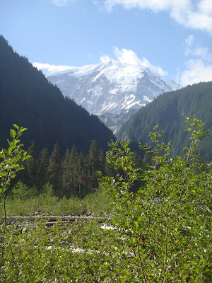
We left camp and started towards the Carbon River. I was looking forward to hiking through the Carbon River Rainforest and seeing the Carbon Glacier. We reached the river and Rainier was out:


Moments after taking this picture clouds rolled in and Rainier would not be seen again on Day 7.

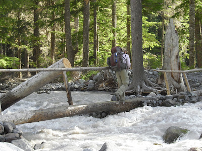
In the Discovering the Wonders of the Wonderland Trail book this section always confused me. Something about a loop and point A, B, C and D. When Curt read it before the trip we has confused too. I decided when we got to this point we would just follow the signs. We got to the first sign which said the trial was closed and we'd have to take a detour. No problem. We just followed the signs. The Wonderland Trail is so well marked it really would be hard to get lost on it. This was the one and only point on the entire map when we pulled out the map "just to make sure" but we were right on track. We crossed several bridges to get to the other side of the carbon river. The water on this one seemed pretty high, I thought:

We enjoyed our stroll in the lush, verdant forest as we made our way up to the Carbon Glacier. Soon we came to the suspension bridge which we didn't really need to go over as we were already on the side of the river we needed to be on but Emily insisted:


Check out the rain clouds in this picture (more on that later.)

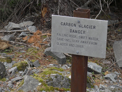
We climbed a bit more and saw this sign:


Followed by these views of the terminus of lowest glacier in the the Lower 48:


The Carbon River being born, coming right out from under the glacier:


How's this for a geology lesson?


While we were there we witnessed a few rock falls (several rocks, small boulders) off the end of the glacier. Just a result of the constant movement of the glacier. Seeing the Carbon Glacier reminded me of the evening we spent on the Big Island in Hawaii. We hiked out to a viewpoint and when the sun went down we could see the fiery lava entering the ocean and creating new land. Seeing the Earth in motion is very inspiring!

As we continued up to Dick Creek Camp we passed a lovely waterfall where we filled up on water: (on second thought I'm not sure this is the waterfall before Dick Creek Camp but I do know it's from Day 7)


As soon as we got into Dick Creek Camp it started to rain. We quickly put on rain gear and pack covers and headed for a little grove of trees just above site 2. We stayed there for an hour while it rained and had lunch. We had really good tree cover there as we didn't get wet at all during lunch.

About halfway through lunch a guy came into camp cursing under his breath... something about how he's from Colorado and in Colorado the trails aren't this steep unless you are climbing a fourteener and he's had it with the steep trails around here. We had a quick chat he told us that he would be camping there that night. We told him we were just finishing lunch and he was welcome to that site. It was raining pretty good at this point and he proceeded to set up his tent in the rain.

Emily had a dehydrated ice cream sandwich for dessert:

We finished lunch and headed out about 20 minutes later and as soon as we got going the rain stopped. There wasn't much rain the rest of the day but the wind started to pick up.


Later in the afternoon we passed through another moraine park full of expansive views (even though it was cloudy), marmots and wildflowers. It was one of the more memorable spots on the trail for me:


We made it to Mystic Lake Camp and decided on site #7 since it was lower and had more tree cover than most of the other sites. We hoped this site would protect us from any wind and rain. It was quite windy all night but never rained. We were so cold from the sweating and the wind just really made it much worse. We quickly got camp set up, put on dry clothes and made dinner in record time. Our only goal was to get in to warm sleeping bags ASAP. By 6:00 we were all in the tent for the night.

Elevation gain for the day was the most of any day the entire trip - 3400 feet. I made it no problem. I felt like I was finally just enjoying the surroundings rather than worrying about whether I could physically do it. I had proven I could do it now the only thing left to do was enjoy every mile we had left.

Gear of the day:
Marmot PreCip Rain Pants


This was splurge purchase but I did wait and use my 2009 REI dividned and a 20% off coupon to get them at a semi-affordable price.

They performed great keeping me dry during a few rainy spells on the trip. They also breathe well. I could definitely see a difference in performance between these and Curt's Kirkland brand rain pants from Costco. For the most part, I've found that in the world of backpacking gear you really do get what you pay for.

Monday, September 13, 2010

Day 6 -- Not my Best Day

South Mowich River Camp to Ipsut Creek Camp
9 miles / 2595 elevation gain

The night was warm and we slept well. Fresh in my mind though were those 32 switchbacks we had descended from Golden Lakes the previous afternoon. I'm no fool and I realize when you're doing a loop hike for every step you take down you have to take a step up. Some people prefer hiking uphill rather than down. I'm not one of those people. At this point I owed the mountain more up than down. This morning we'd be climbing 3.8 miles to Mowich with about 2600 elevation gain in those 3.8 miles. I found this to be the perfect excuse to feel sorry for myself. We didn't make it to camp that night until 6:00 and it was entirely my fault.

This photo is actually from Day one but pretty much surmises how I was feeling during the climb up to Mowich Lake:


It was another beautiful day with blue skies and no clouds. The climb up to Mowich Lake was uneventful except for my pouting. I'm embarrassed to say that it took 4 hours to get to Mowich Lake. Is hiking 3.8 miles in 4 hours even considered hiking? Perhaps "shuffling" would be a better word. Instead of positive thoughts and getting into a rhythm, I longed for flush toilets and water with no floaties. I only cried once.

About halfway up there was a trail that forked off to Paul Peak Trailhead. A week earlier I had driven by that trailhead on my way to Mowich Lake. There were lots of cars and even a ranger at Paul's Peak Trailhead that day. I knew in just a few miles and with less elevation gain than going to Mowich I could be at that trailhead with all those cars and bum a ride to Enumclaw. From Enumclaw, I could make a phone call and have a friend or my sister-in-law there within a hour to put me out of my misery. The thought only lasted a second and I knew I wasn't a quitter. I had made it this far and some guy on the internet said if you can make it to St. Andrews Park then you can do the whole thing. I had passed St. Andrews Park 2 days earlier. I kept moving.

We arrived at Mowich Late about 1:00 where we had two - 5 gallon buckets cached. One of them included food and supplies for the next 3 days. The other bucket was full of food for pig out lunch! We walked over and picked up the buckets and then went back to the campground to try and find a shady spot. It was 85 degrees and little shade to be found. I have to say that Mowich Camp ground is a dump and I would avoid staying there at all costs. I suppose that it does preserve the surrounding beauty by not having the campground in the woods but my idea of camping does not involve and abandoned gravel parking lot with no shade. We got out our lunch bucket which included a 6 pack of soda, ingredients for my favorite trail lunch, Southwest Chicken Wraps, chips, cookies, dried fruit, granola bars and Reese's Peaunut Butter Cups! Best of all we got to eat off a picnic table instead of our laps.

During lunch Emily befriended a pretty little butterfly:


It was fun at first but then after a few shakes of the finger to try to send the butterfly on its way Emily was a little concerned that she had picked up a new hiking partner:


The butterfly finally decided it wasn't up for the Wonderland Trail and flew away....

All I needed was a little junk food and I was feeling back to my adventurous self, ready to hit the trail. On the way out we contemplated a quick dip in the Lake. Mowich is a beautiful and crystal clear mountain lake. I couldn't get over how clear it was. We kept going but later in the day I regretted not stopping for a swim.


We climbed a bit more to Ipsut Pass where we had fantastic views. I was taken aback at the trial below. The trail we'd be descending. Zooey Mama! Boy was it steep! Here's another part of the trail where I just can't fathom that a human being could actually walk up this thing. There were 20 or so switchbacks to get to the bottom and the steepness was insane, sometimes 30 - 40 degree grades.

Here a photo from near the top and you can see the trail below:


Most switchback sections on the WLT are in forested areas so I enjoyed the different fauna here. as well as the views while climbing down. Again, I was very slow descending here. My poles were a lifesaver. Curt and Emily both took tumbles on this section.

When we reached the bottom we entered a very lovely forest. One of the prettiest of the entire trip. There were several streams and greenness everywhere. The trail was pretty gentle grade (for the Wonderland trail) and we just had a very enjoyable walk through this section.

Curt and Emily at a cool tree in the forest. The base was a big, hollow space and you could walk inside:


We finally reached Ipsut Creek Campground at 6:00. This campground used to be a regular drive-in campground but back in 20003 (I think? If it was not 2003 let me know and I'll change it) flooding wiped out the road to this lovely campground. Now it kind of has an eerie ghost town feel to me. There are parking spots, posts and information boards just like at Ohanapechosh and Cougar Campground but no road access. It's now treated as a back country campground. Several of the sites are closed due to dangerous widowmakers. I believe we chose site #15. The pit toilets were actually very clean and they were supplied with toilet paper. Our site had 2 picnic tables. Oooh La La! Isput Creek Campground is the lap of luxury for back country camping.

We ran into a guy who we had met back on day #1. He was hiking counterclockwise. We compared notes of our trips so far. He was a photographer and this was his third time doing the trail. I asked him about Panhandle Gap (we'd be crossing it on day 10) and he confirmed that yes, there are still snow fields there. He went into some technical stuff about crossing icy snow chutes and I started freaking out a little. I'm just a Mom of four who likes hiking and gets most of her ideas out of the Best Hikes with Kids books. I like to pick the "easy" and "moderate" rated hikes but if I'm feeling daring I'll pick a "difficult". I also have the 100 Classic Hikes in Washington book which lists the Wonderland Trail as "strenuous", of course. Honestly, I knew if I was in good enough shape I'd be able to do the climbing. The one part of the trail that really scared me was the crossing of the snow at Panhandle Gap. This year had been a heavy snow year so there would still be plenty of snow to cross. The guy told us that he had actually gotten lost the day he crossed that area due to dense fog and had to use his emergency whistle to find someone to help him. This couldn't be good! An experienced WLT hiker had gotten lost in this section and warned us of the snowy crossings. How will I ever make it? These questions weight heavily on my mind the following days.

It was another warm night so no rain fly again.

Here's Emily enjoying the picnic table to help sterilize the water:


Gear of the Day:
My beloved IPhone 4. We still had not had any cell coverage on the trail but I love the Hipstamatic App. This app allow you to take photos using retro lenses and film for some really cool effects. Since my camera was being difficult the camera 5.2 MP camera on the new IPhone 4 came in really handy. Here's one of the Hipstamatic images from day 8:

Another favorite App on the trail was Yahtzee! Each night after we were all snuggled in our sleeping bags Emily and I would play a game or two to help us relax and unwind from the day's events.

I maybe used the phone 30 minutes / day and it lasted all the way to day 9 (Summerland) where I had service so I ran through the rest of the battery pretty quickly there. :o)